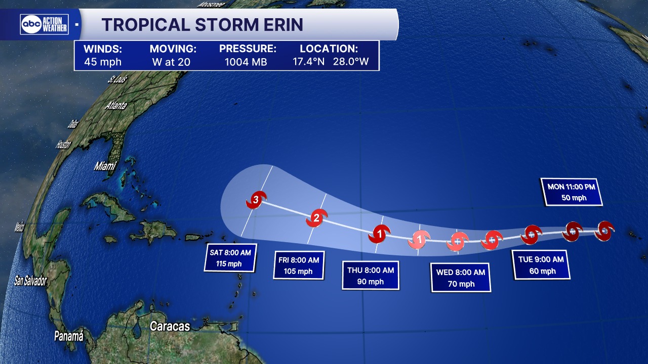
The 2025 Atlantic hurricane season has its latest named storm, as Tropical Storm Erin officially formed today near the Cabo Verde Islands. According to the National Hurricane Center (NHC), Erin is currently packing maximum sustained winds of 45 mph, with tropical-storm-force winds extending outward several miles from its center.
This first official forecast track from the NHC shows Erin moving steadily westward across the open Atlantic. While the system is still thousands of miles from land, forecasters are closely monitoring its development. The current projection calls for steady strengthening over the next several days, with Erin expected to become a hurricane later this week — and potentially intensifying into a major hurricane by the weekend.
For now, Erin poses no immediate threat to land, giving coastal communities plenty of time to follow updates. However, meteorologists warn that tropical systems forming this far east in the Atlantic often have a long journey ahead, with multiple potential track scenarios depending on steering patterns and atmospheric conditions in the days ahead.
Residents in the Caribbean, along the East Coast of the United States, and in Bermuda are advised to remain vigilant and keep an eye on official forecasts as the storm progresses. The NHC stresses that forecast tracks can shift significantly over time, especially when a storm is still far from land.
As Erin makes its trek across the ocean, forecasters will be watching for signs of rapid intensification, a phenomenon more common when storms move over warm waters and encounter favorable wind patterns. By late week, environmental conditions appear likely to support significant strengthening.
The formation of Tropical Storm Erin is a reminder that the peak of hurricane season is approaching, historically occurring from mid-August through late September. Preparedness now can make all the difference later.
The NHC will issue regular updates, including new track forecasts, wind speed probabilities, and intensity projections, as Erin moves westward. For the latest and most accurate information, always refer to official NHC advisories.
Leave a Reply